There are plenty of hiking options near Reykjavík. If you are up for a hike, try out one of these mountains.
Mt. Esja
Dominating the Reykjavík City skyline and providing a stunning backdrop to the capital area is the majestic Mt. Esja, often called Esjan. Its proximity to the city has given it a special place in the hearts of Reykjavík locals, most of whom would have no way of figuring out which way north is without a view of the mountain. It’s even a popular motif in poems about Reykjavík, many of whom romanticise the view of the mountain across the water from the city centre. Esjan is a popular destination for hikers – no wonder, because the view from the top of this 914m mountain is breathtaking.
There are different routes up and around the mountain, and you can climb to a few different peaks, varying in terms of difficulty. The most popular route is to climb up (or towards) the peak Þverfellshorn, at an altitude of 780m. The path is divided into sections, with signs along the way, and the bus from Reykjavík stops by the parking lot of Mt. Esja. Each sign gives an indication of the difficulty of the path ahead with a grading system ranging from one boot (easy) to three boots (challenging). Approximately 200m from the top, there’s a point marked with a big rock called Steinn. Most inexperienced climbers choose to stop here and take in the view before going down again, as the path becomes increasingly difficult from there on, rockier and steeper. If you do get to the top, don’t forget to sign the guestbook!
Mt. Esja is located in Kjalarnes, past the town of Mosfellsbær east of Reykjavík. It is accessible by bus no 15 from Hlemmur bus stop. Get off at Háholt in Mosfellsbær, then take bus no 57 to the foot of Esja at Esjuskáli.
Mt. Helgafell
If Esjan is the most popular hiking route in the area surrounding Reykjavík, Helgafell is a close second. Not as steep as Esjan, Helgafell is perfect for a family hike. Hafnarfjörður is a little town right next to Reykjavík, known as the town on the lava field. Surrounding it is a rough and rugged lava field, partly covered by puffy moss and other flora. In other words, it feels like an extraterrestrial landscape.
Helgafell isn’t tall, just 338m, and isn’t steep either, so it’s ideal for a family outing. Despite not being particularly tall, the landscape surrounding Helgafell is relatively flat which means that the view from the top over Hafnarfjörður and a bit farther away, the city of Reykjavík, is pretty great.
Just make sure you’re heading to the right mountain, especially if you’re using a GPS to help you get there. Helgafell is a common name for mountains in Iceland and there is another one in Mosfellsbær and a famous one on Snæfellsnes peninsula.
To get there, drive to Hafnarfjörður like you were on your way to the airport but before you leave town, turn onto Kaldárselsvegur and continue on that way until you get to the parking lot where the hiking trail starts.
Mt. Keilir
For most visitors to Iceland, one of the first Icelandic mountains they see is Mt. Keilir, an almost perfectly cone-shaped mountain on the way from Keflavík Airport to Reykjavík. Keilir’s perfect shape rising from the flat lava fields around it, makes it almost look like a cartoon mountain and it’s certainly a striking one, rising from the blackness of the lava. The curiously flat landscape surrounding the conical mountain makes sure that it sticks out, so much so, in fact, that Keilir was for years used by sailors as a guide when sailing in the rocky waters around the Reykjanes peninsula.
Despite its looks, Keilir is not actually a volcano. Instead, it was formed during a volcanic eruption underneath a glacier, resulting in the unusual shape. Keilir is not particularly tall, a little under 400m above sea level. The slopes aren’t steep either, so the hike is not particularly difficult, just enough to be challenging! The hike to the top is 7km and takes about two to three hours.
If you want to add a hike or don’t feel like climbing the mountain, there are plenty of hiking trails surrounding the mountain as well.
Keilir lies southwest of Hafnarfjörður. Take route 41 out of town like you were on your way to the airport, then turn onto road 420 which leads to the parking lot where the hike up to Keilir starts.
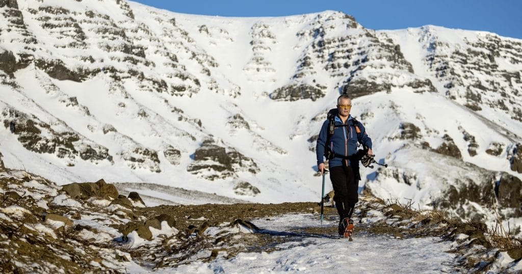
Please remember to take care when climbing. Even though these are popular hiking spots, the notoriously fickle Icelandic weather can be tricky at higher altitudes and there can even be snow on upper slopes. It can also be steep in places, so make sure your shoes are up for the task! Follow your chosen route closely and check what the weather conditions are like before attempting a climb. Always let someone know where you’re going and when you intend to be back.
Fagradalsfjall/Meradalir
Keilir may not be a volcano, but Iceland’s most recent volcanic eruption site is close by. Fagradalsfjall mountain erupted in March 2021 and immediately drew locals and tourists alike to witness nature’s fury. The lava stopped flowing in September that year, but a new fissure opened up nearby in August 2022. The lava from these eruptions flows slowly, and visitors have been able to get close to the volcanoes. The eruptions are now both over, but they continue to be a popular hiking spot with both residents and Icelanders alike. There are now several paths to choose from, ranging from 1 to 4 km in distance.
Use extreme caution! Do not walk on the new lava, even if it looks cooled on the surface. Lava retains heat for months and even years after eruptions and the cooled outer shell is liable to crack, revealing the dangerously hot lava underneath. The terrain can also be jagged and brittle.
PLEASE REMEMBER to take care when climbing. Even though these are popular hiking spots, the notoriously fickle Icelandic weather can be tricky at higher altitudes, and there can even be snow on upper slopes. It can also be steep in places, so make sure your shoes are up for the task! Follow your chosen route closely and check what the weather conditions are like before attempting a climb. Always let someone know where you’re going and when you intend to be back. The two eruption sites are close to each other, about 10 km (6.2 mi) outside of the village of Grindavík on the Reykjanes peninsula. From Reykjavík, you take route 41 as if you are going to Keflavík Airport. Turn left onto route 43 towards Grindavík. This will take you through the town, but you will take another left onto 427, leading you to the
designated parking areas. You will pass the Fagradalsfjall site on the way to Meradalir.
Last updated: 15 May 2023.